Geological mapping is a traditional technique and craft which remains as one of the most important tasks in mineral exploration, despite the development of new tools and exploration for deeper-seated deposits. Only geological mapping based on careful field observations can trace geological contacts and structures, what ultimately allows a three-dimensional interpretation of the geologic framework. No modern instrument or technology replaces mapping field work, but are welcome additions to the tool box. Geologic maps and derived three-dimensional models remain the pivot centerpieces of all additional multi-disciplinary data sets. The technical excellence of any exploration program depends on the quality of geologic mapping.

Mapping geology is a craft similar to hunting which requires field practice and experience but cannot be learnt alone from a book or in a class room.
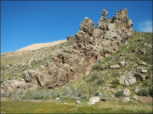
This holds especially true for exploration mapping where alteration overprint and mineralization, often with complex structural or lithologic controls, add additional levels of complexity to the task at hand.
Teaching geologic mapping ideally involves field training on top of theoretical knowledge of geological concepts and techniques. However, there are many theoretical aspects and topics which are best taught as classes and exercises in preparation for field work.
Offered mapping course(s) focus on practical skills and situations of exploration mapping. The topics outlined below are theory classes that can be taught as individual modules or as block course.
They can (should) be complemented with field training if logistics and access to training ground can be provided. Field training could be done in small groups over several days or coaching geologists with frequent visits during their project work.
Interested parties please contact for further details.
Course modules:
Module “The evolving geological mapping tool box”
This module shows the evolution of geologic mapping from past to present. Emphasis is on the presentation of different tools which assist geologic mapping from reading nature to modern sensors and handheld devices.
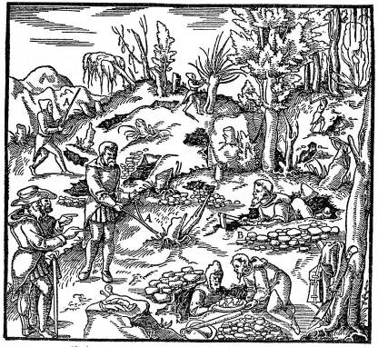
Geologic field mapping during the 19th to 20th centuries produced amazingly accurate geologic maps that hold the test of time which were just based on good field observations together with knowledge of mineralogy and paleontology. Nowadays we are fortunate to have many new tools that assist geologic mapping.
The course gives an overview on the currently available tool box and explains how these tools can contribute without forgetting the techniques of traditional field work.
- The evolution of geologic mapping
- Geologic mapping in the digital age
- The evolving tool box – traditional and modern tools
- Practical aspects of working with mobile devices in the field


Module “Reading and construction of geologic maps”
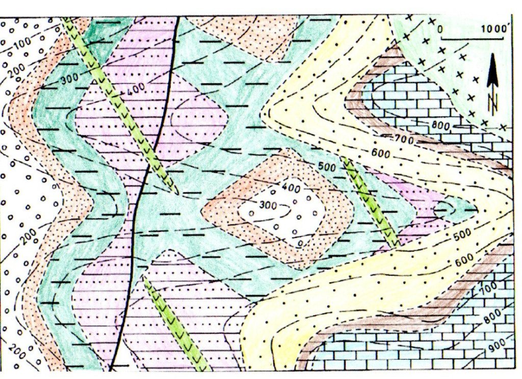
This module aims to restore and improve basic map construction skills that ultimately allow intuitive reading of geologic maps in 3D and 4D. Having this skill set ingrained provides the mapper with the ability to develop and continuously test geologic models while progressing in the field. Theoretic concepts are accompanied by construction and interpretation exercises.
- Elements of a geologic map
- The relevance of topographic contour lines in geologic maps
- Reading a geologic map in 3D
- How to determine the orientation of planes and lineaments from a map
- How to determine fault offsets from a map
- How to determine the geologic history from a map


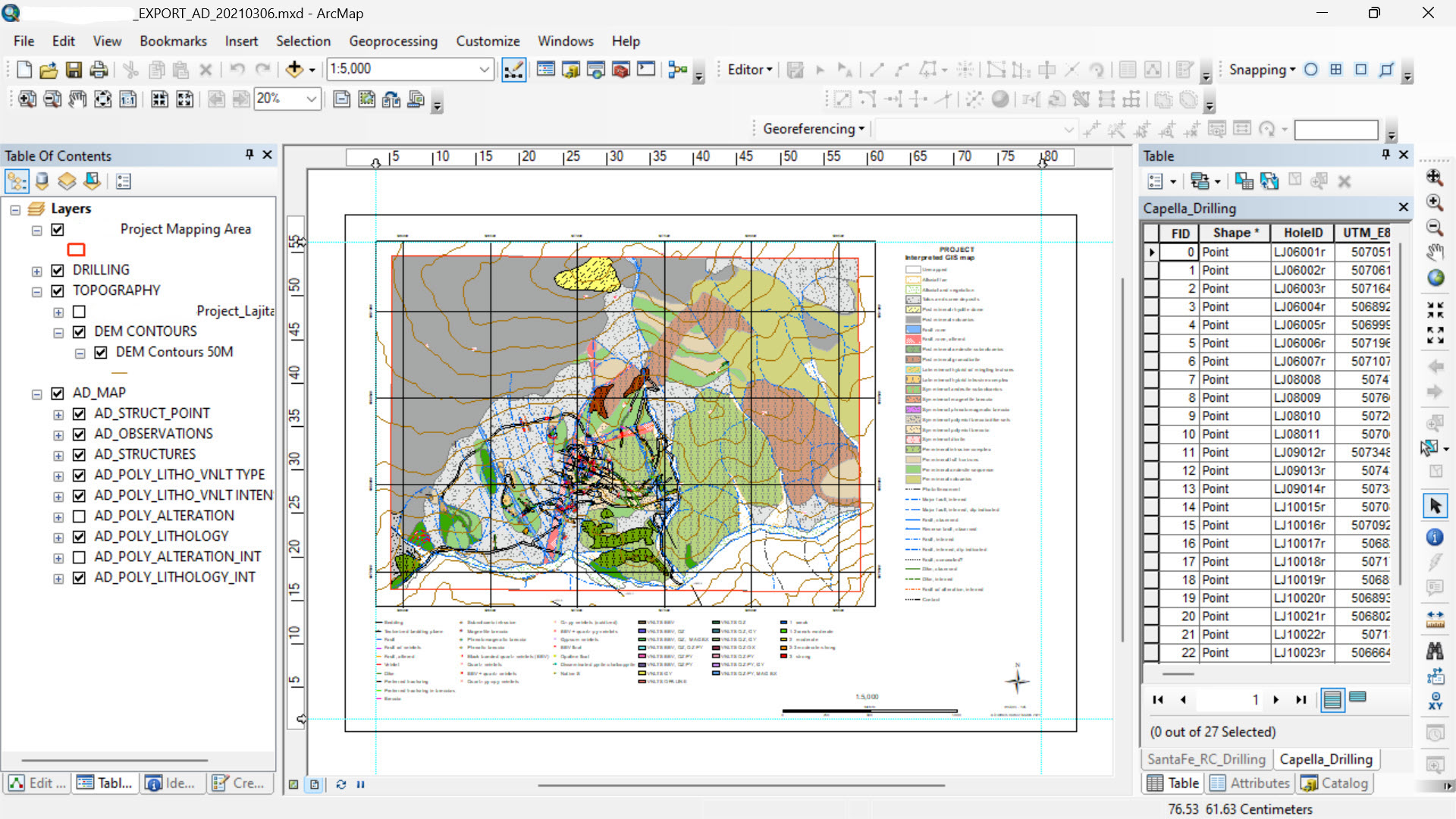
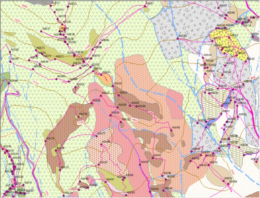
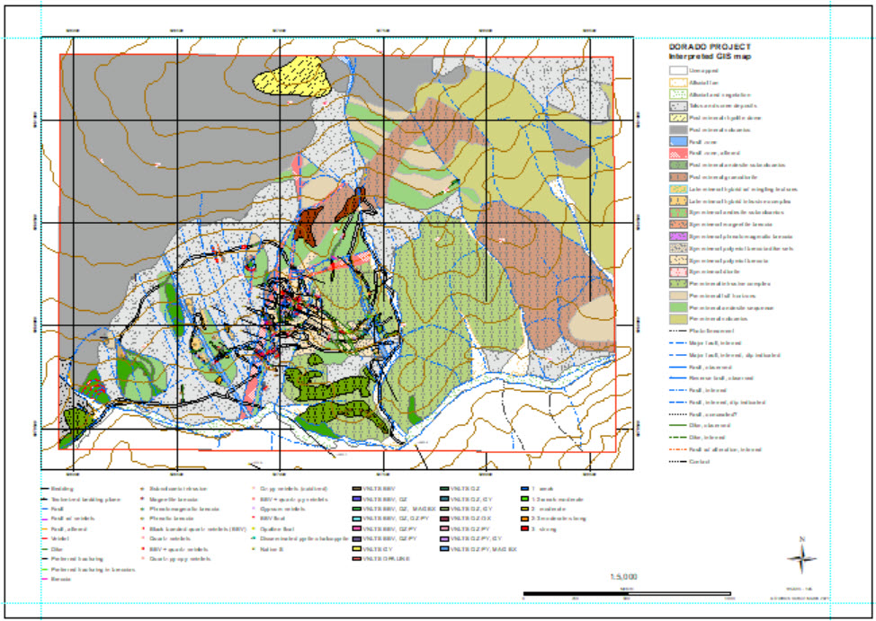
Module “Geographic Information System GIS in geologic mapping”
This module aims to provide the exploration geologist with practical guidance from how to set up a GIS project for mapping and initial collection of field observations to final data integration, interpretation, and production of deliverables.
- Overview of GIS software solutions and hardware requirements
- Setup a GIS project for field mapping exercise
- Generation of base maps
- Integration of public data
- Integration of exploration
- Integration of drill hole data
- GIS data collection in the field: Documentation and data entry of field observations
- GIS creation of fact maps and interpreted maps
- Preparation of final map and GIS products


Module “A field mapping job: From start to finish”
This module will go over the three main stages of a mapping campaign from preparation to final products.
1) Preparing for field work
- Working questions and mapping scales
- Considerations of budget and time frames
- Base maps
- Topographic data
- Setup of GIS project
- Field gear and equipment
- Logistics and communication
- Field safety
- Community relationships
2) Field work
- How to most of your limited field time
- Documentation of field observations
- Mapping on paper
- Digital mapping with tablets and apps
- Orientation in the field
- How to move – systematic data collection in the field
- Definition of map units
- Zoom in – zoom out: Different mapping scales and perspectives
- Stratigraphy and geologic facies variations
- Mapping in sedimentary rock environments
- Mapping of volcanic and intrusive rocks
- Mapping in metamorphic environments
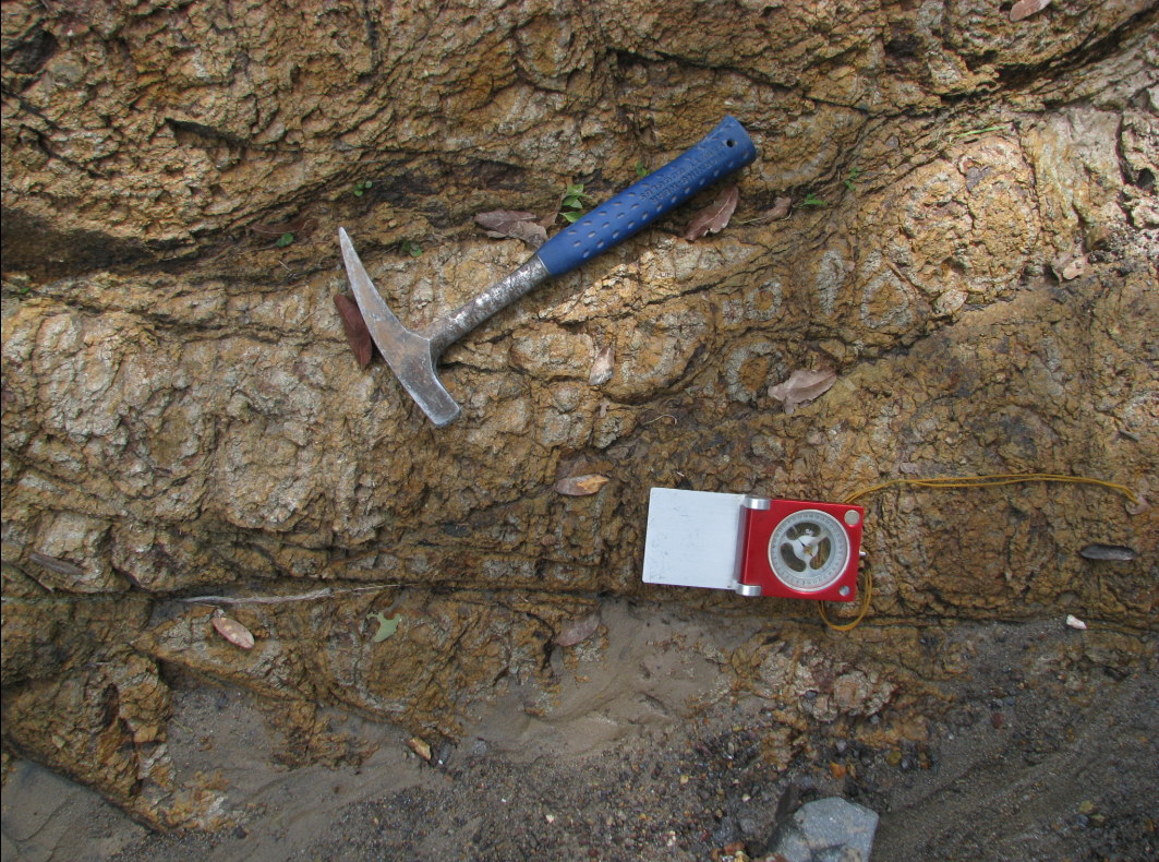
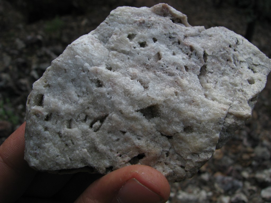
- Mapping hydrothermal alteration and mineralization
- Recognition of intrusions and cross-cutting breccias
- Mapping with morphology
- Mapping with soil types and vegetation
- Float mapping
- Sampling methods
- The master map – keeping an overview of mapping progress
3) Final office work
- Back from the field – and now?
- GIS integration of field data
- Preparation of separate lithologic, alteration, and structural GIS layers and map products
- Map interpretation: From fact map to interpreted map
- Section work
- Integration of additional exploration data
- Final map and GIS products
- Report, figure, illustrations

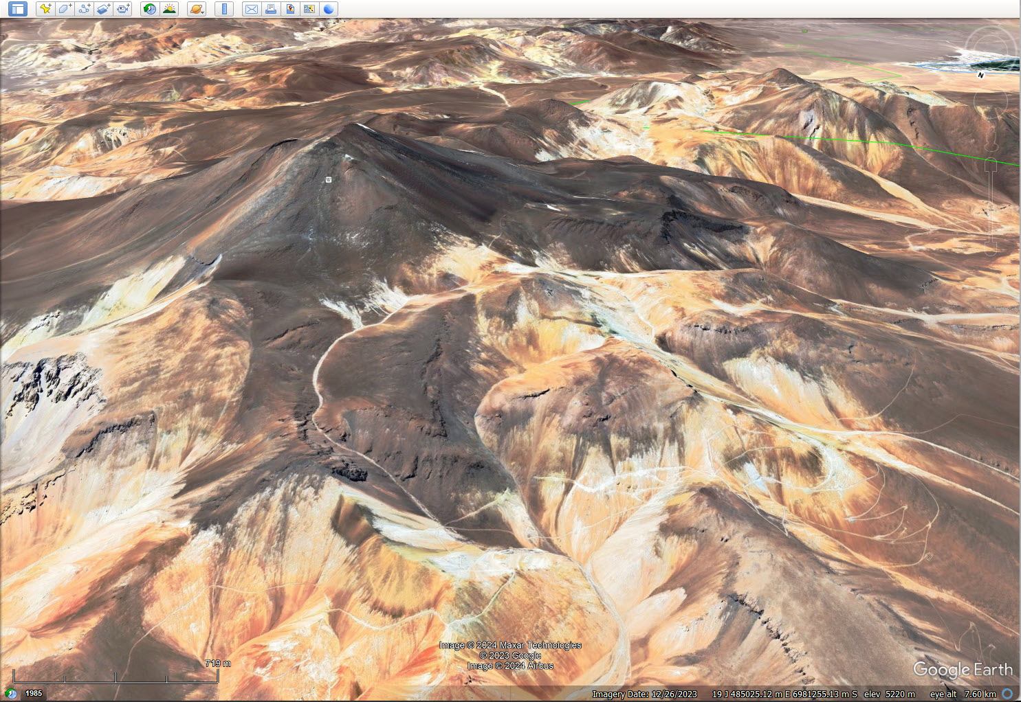
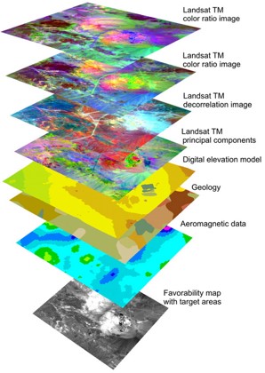
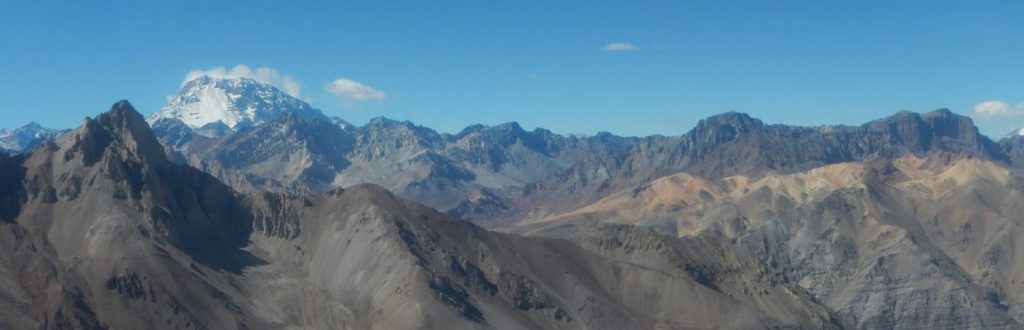
Module “Mapping of satellite imagery”
Satellite imagery is always at our fingertips, on our cell phone or computer. It provides a rich source of geographic and geologic information and is nowadays the natural base of almost all geologic mapping. This module aims to go over the practical aspects of mapping satellite imagery in order to generate products which subsequently can be integrated into final GIS map products.
- Image types and sources
- Selection and preparation of basemaps for mapping
- What can be mapped from satellite imagery and ways how to do it
- Common practical problems
- Dealing with distortions of imagery
- Limitations and ground truth

Module “Alteration and mineralization mapping”
This module touches the essence of geologic mapping in mineral exploration: How to map a hydrothermal system or ore body? In order to map those one has to have a good command on how these systems work, knowing the principal processes and resulting geometries from top to bottom and proximal to distal with emphasis on epithermal to porphyry-style systems. The course aims to provide practical guidance on how to map such systems without going into the finer academic details.
- Types and zoning of hydrothermal systems
- Alteration styles and alteration mineral assemblages
- Veinlet types in porphyry systems
- Cross-cutting relationships
- Overprinting alteration styles
- Anaconda style mapping
- Hyperspectral data: Data handling and interpretation
- Structural and lithologic controls of hydrothermal fluid flow, alteration and mineralization
- Mineral exploration under cover

Module “Structural mapping”
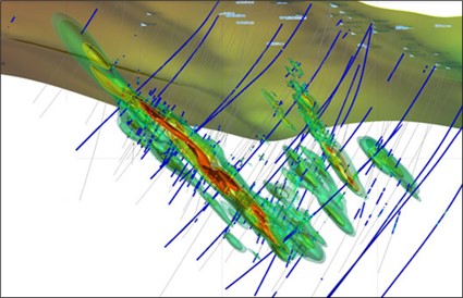
Structural mapping is often considered an expert topic, but it does not require a Ph.D. degree in structural geology to do basic structural mapping. The course module aims to provide the geologist with the necessary tools and confidence to map the structural inventory of the project area, which ultimately allows the definition of tectonic blocks, offsets between erosion levels or other displacement of the mineralized system. Another focus is on the exploration of vein systems where a better understanding of the structural controls of mineralization such as ore shoot geometry provides with tools for more efficient exploration and drill hole design.
- Structural elements to map in the field
- Fault types and how to recognize a fault in the field
- How to define the geometry of a fault
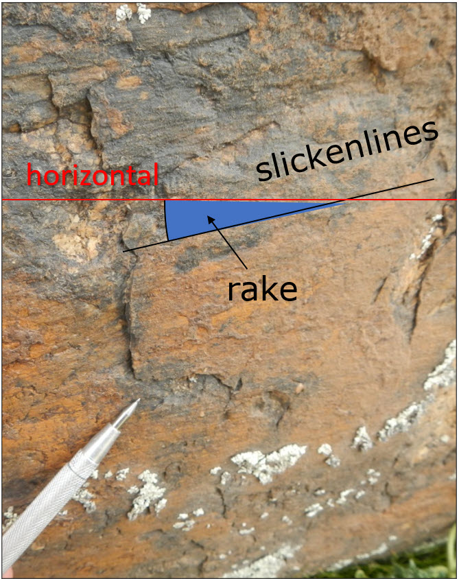
- Kinematic indicators
- Collection of structural data in the field
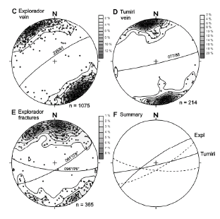
- Presentation and analysis of structural data
- Structural controls of ore deposits – an overview
- Mapping of veins
- Structural controls of ore shoot geometries and consequences for drillhole design
- Definition of tectonic blocks and their erosion levels
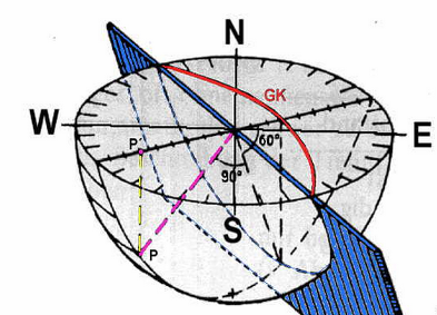
- Stereonet: Plotting of planar and linear data and practical concepts for mineral exploration


Special mapping techniques
Several work situations require a certain approach to mapping. Why re-inventing the wheel? Traditional mapping techniques help to generate useful products.
- Trench and roadside mapping
- Underground and open pit mine mapping
